The Story Behind Portland's Ceramic House Numbers
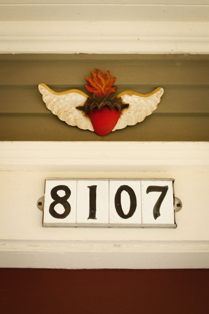
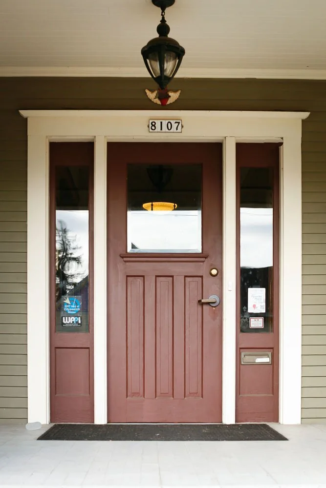
When we bought our house in Sellwood in 2005, it had them above the front door. We did not give them a second thought at the time, the way you do not think much about the details that have always been there.. Four white ceramic tiles in an aluminum bracket, black numbers on a white field, the same ones you see on older homes all over Portland. When we repainted and updated the exterior a while back, they came down. But I held onto them, and coming across them recently sent me down a rabbit hole I had been meaning to go down for years.
The first time I really noticed them was when a longtime Portlander mentioned them in passing, the way locals mention things they have always known and assume everyone else has too. There was apparently a whole story behind those tiles. I filed it away and finally looked it up.
Before the Numbers Made Sense
Portland in the early twentieth century was a navigational mess. The city had grown by absorbing surrounding communities, including East Portland, Albina, and St. Johns, each of which had its own street naming conventions and numbering logic. By 1891 there were twelve streets called A Street, twelve called B Street, twelve called First Street, and nine called Cedar Street spread across different parts of the city. Finding a specific address required local knowledge that visitors and newcomers simply did not have.
The numbering was equally chaotic. Different neighborhoods used different baselines. Only twenty numbers were assigned per block in some areas. An address of 401 might place you at the corner of 10th Avenue on the west side of the Willamette but off Fifth Avenue on the east side. Letters got lost. Deliveries went to the wrong houses. Even postal carriers struggled.
The Plan
By the mid 1920s, city engineer Olaf Laurgaard and City Commissioner Asbury Lincoln Barbur had seen enough. Barbur assembled a group to study how other cities had solved similar problems and landed on a system modeled in part on Milwaukee, Wisconsin, which had developed a logical grid-based approach.
The plan used the Willamette River as the east-west baseline and Burnside Street as the north-south baseline, dividing the city into quadrants. Streets were renamed and renumbered so that each block received 100 numbers, and any address on any street would tell you roughly how many blocks you were from the center of the city. It was elegant in its simplicity, and on September 2, 1931, the city council passed it unanimously.
The Work
What happened next is the part of the story that stays with you.
Portland was in the depths of the Great Depression. The city allocated $10,000 to pay for ceramic number tiles for every house and building in the city and put unemployed men to work installing them. From the fall of 1931 through the summer of 1933, crews fanned out across 66 square miles of Portland, pulling wheeled carts loaded with ceramic tiles, aluminum brackets, hammers, and nails. Workers had to be, as one 1933 Oregonian article put it, young and spry enough to mount stepladders.
The winning bid to supply 150,000 house numbers went to Gladding, McBean and Co. at 4.75 cents per number. Aluminum frames were supplied by Portland Metal Spinning Works. A two-digit frame cost 10 cents. A four-digit frame cost 6 cents. The whole project took 23 months.
Not everyone was pleased with the results. Some residents were unhappy to be assigned addresses containing the number 13.
What It Gave the City
When the Oregonian covered the completion of the project in July 1933, the paper summarized the community response this way: the new system meant a logical and simple way out of a puzzling network of miscellaneous addresses for business owners, tradespeople, and ordinary citizens alike.
It also gave Portland something that has quietly shaped how the city feels to navigate ever since. The quadrant system, the sequential numbering, the predictable logic of knowing that an address in the 3000s is roughly 30 blocks from Burnside, all of it came from that two-year project. When people say Portland is easy to get around, this is part of why.
The Tiles Themselves
The original black on white ceramic tiles in aluminum brackets have outlasted most of the decisions made in the 1930s. You still see them on homes throughout Sellwood, Woodstock, Irvington, Alameda, and other established Portland neighborhoods. Some are original. Some are reproductions. Clay Factor Ceramics in Portland still makes faithful replicas. Hippo Hardware has carried them. Rejuvenation sold a version for years.
Our tiles came down when we repainted. They are sitting in a box now, which feels like the right place for them. Part of the house's history, even if they are no longer on it.
If you walk Portland's older neighborhoods and pay attention, you will start seeing them everywhere. Each one is a small remnant of a two-year civic project that put people to work during the Depression and made a complicated city legible. That is a lot of history for four ceramic tiles in an aluminum bracket.
Why walking is one of the best ways to understand a neighborhood
You can look at a neighborhood on a map and read every statistic available, but a thirty-minute walk will tell you things that data cannot. What is the tree canopy like? Are the sidewalks consistent? Are people outside? Is the commercial strip walkable from the residential streets, or do you need a car to get anywhere? Are there families, older residents, younger renters, or a mix?
If you are thinking about buying in Portland, walking the neighborhoods you are considering is genuinely useful homework. It shifts the question from "does this neighborhood have good numbers" to "do I actually want to live here."
Guided walks with the Architectural Heritage Center
One of the most underutilized resources in Portland is the Architectural Heritage Center, based at 701 SE Grand Avenue. From March through November, they run guided walking tours of historic neighborhoods throughout the city, led by historians and preservation specialists who know the built environment in real depth.
Recent and upcoming tours cover a wide range of neighborhoods: Ladd's Addition, Irvington, the Pearl District, Hawthorne (Sunnyside), Laurelhurst, Mt. Tabor, the South Park Blocks, Skidmore Old Town, and others. Some tours focus on residential architecture and neighborhood development. Others go deeper into specific communities or cultural histories, like the Chinatown and Japantown tour, the Volga German churches and homes of Albina, or a tour of Native American public art through downtown.
Tours are two hours and approximately $25 per person, most start at 10 AM, and they do sell out. If you are relocating to Portland or seriously considering a neighborhood, attending one of these tours is a genuinely good use of a Saturday morning. You leave knowing things about a place that you simply would not have found on Zillow.
You can see the full schedule at the Architectural Heritage Center website.
Other ways to explore Portland on foot
The AHC tours are structured and historical. But there are other ways to use walking as a research tool.
Around Portland Tours runs several guided options, including a "Soul of the City" downtown walk focused on art, architecture, and culture, a chocolate and coffee tour, a coffee roasters tour on the inner eastside, and a Forest Park hiking option that starts in Northwest Portland. Their eastside tours in particular are good for understanding the industrial-to-residential transformation that shaped neighborhoods like the Central Eastside, and the coffee roasters walk is a good excuse to spend a morning in one of the more interesting corners of the city.
The Portland Bureau of Transportation has published a set of free downloadable walking routes through various neighborhoods, including Concordia, Cully, the Jade District, Reed College, and St. Johns. These are practical, well-mapped routes with turn-by-turn directions and mileage. They are not tours in the traditional sense but they are useful if you want to walk a neighborhood systematically rather than just wandering.
For people who prefer to go at their own pace with some structure, the GPSmyCity app has several Portland routes that guide you through the city via GPS, with context about what you are looking at along the way.
A few neighborhoods worth walking
If you are using walks as a way to understand where you might want to live, here are a few that tend to change people's thinking.
Ladd's Addition in Southeast Portland’s Richmond neighborhood is one of the only neighborhoods in the city laid out on a diagonal grid, with a central rose garden and four smaller rose gardens at each quadrant intersection. It reads completely differently in person than it does on a map. The housing stock is early twentieth century and well maintained, and the neighborhood sits in a flat part of the southeast that is easy to walk in every direction.
Irvington in Northeast Portland is one of the city's most architecturally intact residential neighborhoods, with a range of home styles from the 1890s through the 1930s along a fairly consistent street grid. The AHC runs multiple Irvington tours because there is genuinely that much to see. It is also a good neighborhood to walk if you are curious about what the northeast looks and feels like at a residential scale.
Sellwood in Southeast Portland sits along the river and has a small-town commercial corridor that functions as an actual neighborhood center. It is also close to Milwaukie, which is worth walking separately if you are weighing Portland proper against the inner suburbs.
The Pearl District on the west side illustrates a different kind of Portland development. What was a warehouse district a few decades ago is now one of the city's densest residential and retail corridors. Walking it alongside Nob Hill to the northwest gives you a good contrast between two very different kinds of urban living, and helps illustrate why some buyers are drawn to the west side's more polished infrastructure while others find the eastside's texture more interesting.
What walking actually tells you about buying
When buyers come to us having already spent time in the neighborhoods they are considering, the conversations we have are almost always more productive. They have specific questions. They have already ruled some areas out and have a clearer sense of what they are actually looking for.
Portland is a city where neighborhood identity is real and matters. Two addresses that look similar on paper can feel very different on foot. The river, Burnside, and the quadrant system give you the map. Walking gives you the city.
If you are trying to figure out where you fit in Portland, we are happy to talk through what different neighborhoods tend to offer and what questions are worth asking before you decide. No pressure, just a conversation.
Looking for the Right Portland Neighborhood?
Portland neighborhoods vary more than most people expect. Our guide tothe best Portland neighborhoodscovers the city's main areas by location, character, and what it is actually like to live there.
Curious About Portland's Neighborhoods?
We have spent years exploring every corner of this city and built Portland neighborhood guides to share what we know. If you are trying to figure out where you fit in Portland, that is a good place to start.
Kim Campbell, Realtor | PSA, RENE | Licensed Oregon Broker
Francisco Salgado, Realtor | MCNE, EA | Licensed Oregon and Washington Broker
Campbell Salgado Real Estate Group with Soldera Properties